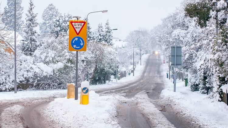
We’ve been treated to a week and a half of lovely weather here in the UK. Sunshine that stays for days without fail is delightful, but also slightly eerie when you’re so used to classic British grey skies. Will we be cosmically punished for pushing our luck with the weather this early in the year? The answer, it seems, is yes.
The polar vortex is weakening. No, that isn’t the tagline for the new season of Doctor Who, it’s a real prediction from the Met Office. Despite sounding very ominous, this is actually nothing to be too worried about, although it does mean your winter jackets will have to make a reappearance.
In short, a rare weather event could result in freezing temperatures across March in certain parts of the UK, primarily the north and east of Scotland. Here’s everything you need to know about the Met Office’s long-term forecasts for the rest of March.
What is the polar vortex, and what happens when it collapses?
The polar vortex is much less cool than it sounds. According to the Met Office, it is a ‘circulation of winds high up in the stratosphere’ which moves at more than 155 miles per hour nearly 30 miles above the surface of the Earth.
In simple terms, a strong polar vortex means less snow, and a weaker one means the opposite. Sometimes an event called ‘sudden stratospheric warming’ causes it to weaken so much that we really start to feel the effects. This is what is being forecast at the moment.
Remember those snowstorms in 2009-10? Or the ‘Beast from the East’ back in 2018? Some meteorologists speculate that both of these were the result of sudden stratospheric warming; although this year conditions are not expected to be quite that severe for us in the UK. The majority of Britain is likely to see cold temperatures, but no snowstorms.
Met Office update – polar vortex collapse forecast
The latest Met Office update has stated that: ‘The stratosphere polar vortex is now weakening rapidly.
‘Over the last few days, the forecasts have become very confident and we are almost certain there will be a sudden stratospheric warming in mid-March. This is when the mid stratospheric wind is predicted to reverse from westerly to easterly.’ This reverse will bring with it chilly breezes and the potential for snow. In terms of when this will happen, the Met stated that: ‘SSWs don’t always impact our weather but if they do it can take a few weeks before impacts might be felt on the earth surface.
Basically, if we do feel effects, it won’t be until next week or beyond.
Despite this statement, the Met Office’s long range forecast, that is from March 10-19, for the majority of the UK predicts largely clear skies with bursts of rain and ‘temperatures lower than normal’.
The BBC is also predicting slightly colder weather, but assert that long-range forecasts are, as always, uncertain and subject to change.
Which counties in the UK are expecting snow?
At present, it seems that the only places at risk of freezing temperatures, icy rain, or snow, are in north and eastern Scotland. This means places like the Scottish Highlands, and Aberdeenshire are at the most risk. The rest of the UK can relax – you will likely just need a hat and a warm jumper.
Some WX Charts weather maps show snow in England, too, with white stuff forecast for Dorset, Somerset, Wiltshire, Gloucestershire, Worcestershire, Warwickshire, Staffordshire, Derbyshire, West Yorkshire, North Yorkshire, Durham, Northumberland and Cumbria.
The northern lights will return to the UK with an extraordinary display this month
Plus: These are the best places to go stargazing in the UK.
Stay in the loop: sign up to our free Time Out UK newsletter for the latest UK news and the best stuff happening across the country.

