[title]
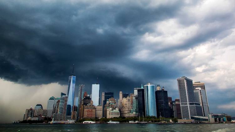
Update: Dark, rotating clouds could be coming, New York. A tornado watch has now been issued for today until 4pm. New York City has moved up to an "enhanced risk" for severe weather. A tornado watch means conditions are right for tornadoes to form.
The tornado threat from Tropical Storm Isaias has increased for portions of the area. SPC has issued an Enhanced Risk of severe weather for parts of the area for a 10% chance of tornadoes. A tornado watch is in effect until 4 PM. #NYwx #NJwx #CTwx #NYCwx #LIwx pic.twitter.com/vtTUYpcU2e
— NWS New York NY (@NWSNewYorkNY) August 4, 2020
The city is still also under a tropical storm warning and a flash flood watch, according to the National Weather Service. High winds from the storm are likely across the NYC throughout the afternoon.
The city's emergency management agency tweeted today that "due to Tropical Storm Isaias, swimming and wading are not permitted at all NYC beaches until 8/5."
A tropical storm warning has been issued for New York City as Isaias moves up the east coast.
After breezing by Florida this past weekend, the storm is expected to strengthen into a hurricane Monday and hit the Carolinas.
The NYC National Weather Service predicts that Isaias is on track to affect the New York area starting Tuesday morning.
New Yorkers should be prepared for heavy rain, flash flooding and possible tropical storm level winds, which equates to 40-50 mph. Be sure to bring in any outdoor furniture and objects. Yes, that means stashing the lawn chairs on your apartment roof or the plants on your fire escape as they can be hazardous.
Our entire area is now under a Tropical Storm Warning through early Wednesday morning. Make last minute preparations today before conditions deteriorate Tuesday morning. #NYwx #NJwx #CTwx pic.twitter.com/4bLTq5qREF
— NWS New York NY (@NWSNewYorkNY) August 3, 2020
Here is our latest overview of impacts for Tropical Storm Isaias. Tropical Storm Watches and Warnings are issued for the entire region with heavy rain, coastal flooding, and strong winds being just some of the expected threats through Tuesday evening. #NYwx #NJwx #CTwx pic.twitter.com/jRHt7tn2AE
— NWS New York NY (@NWSNewYorkNY) August 3, 2020
The flash flood watch issued is for 6am Tuesday until 6am Wednesday, says New York City Emergency Management Department. The five boroughs could see between 2 and 4 inches of rain; with some areas to experience rainfall totals of up to 6 inches.
Mayor Bill de Blasio said Monday that temporary flood barriers are being set up in Lower Manhattan in preparation of Tropical Storm Isaias. As Lower Manhattan is particularly vulnerable, emergency management workers are deploying these flood protection measures.
“This is exactly what you’ll see from the area around South Street Seaport going all the way down toward Wall Street,” he said. “This is crucial. This is going to help protect the community right around there that got hit very hard in Sandy.”
Most popular on Time Out
- You can now rent a “backyard” on the waterfront at Pier 17
- NYC is getting its first-ever Sour Patch Kids store
- 13 hidden patios, backyards and gardens for outdoor dining in NYC
- You can now download recipes from some of Astoria’s best restaurants
- Take an exclusive first look at Eataly’s new summer rooftop restaurant

