
[title]
Here is a little secret about New York: as costly as the city is, there are a ton of ways to save some cash on every day expenses like transportation costs—you just have to know about the tricks of the trade.
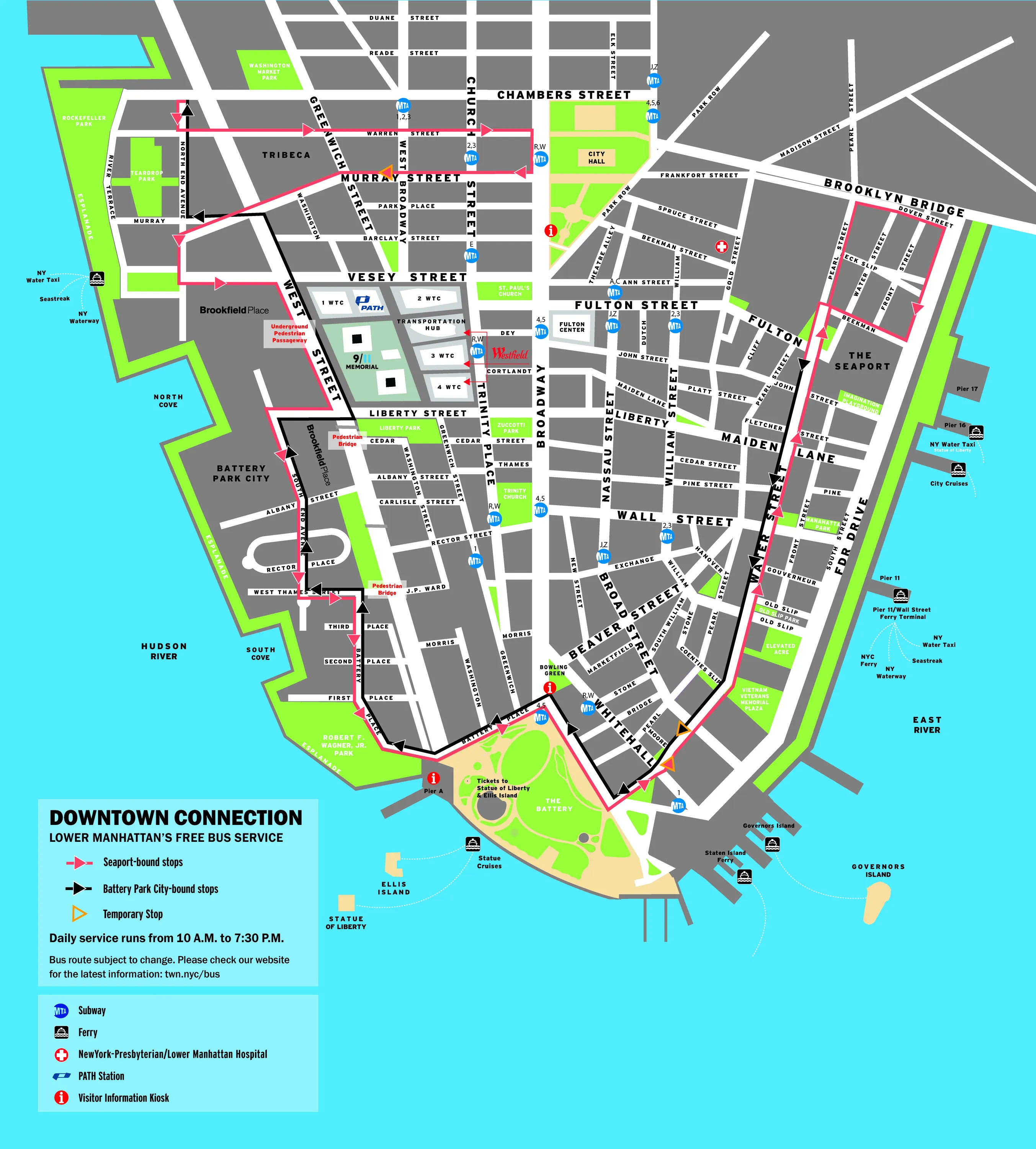
Case in point: the Downtown Connection bus that has been serving lower Manhattan and Battery Park City for 15 years now. The service boasts five state-of-the-art, bright red buses that run daily from 10am through 7:30pm.
Each vehicle can seat up to 22 passengers at once while running through 33 different stops in the downtown area on a loop.
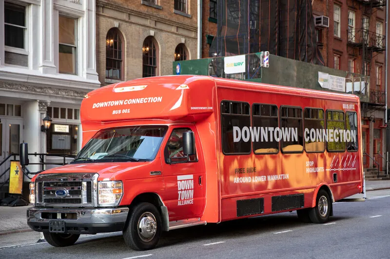
The service is pretty straight-forward: you see the bus, you hop on—no need to pay or scan any sort of document.
Although locals use the mode of transport to get around the area, the bus happens to make for a great tour guide as well: all the stops are at major sightseeing destinations, including One World Trade Center (the tallest building in the United States!), Battery Park City and the Staten Island Ferry. May we suggest you take the free bus to the ferry and head to Enoteca Maria, the famous restaurant staffed by grandmothers from all over the world?
Here is a list of all the bus stops:
1. North End Avenue & Warren Street
2. Warren Street & Greenwich Street
3. Warren Street & Church Street
4. Murray Street & Broadway
5. Murray Street & Greenwich Street
6. North End Avenue & Murray Street
7. Vesey Street & North End Avenue
8. South End Avenue & Gateway Plaza
9. South End Avenue & Rector Place
10. West Thames Street & South End Avenue
11. Battery Place & 3rd Place
12. Battery Place & Washington Street
13. State Street & Whitehall Street
14. Water Street & Whitehall Street
15. Water Street & Old Slip
16. Water Street & Wall Street
17. Water Street & Fletcher Street
18. Pearl Street & Fulton Street
19. South Street & Peck Slip
20. Water Street & Fulton Street
21. Water Street & Pine Street
22. Water Street & Gouverneur Lane
23. Water Street & Coenties Slip
24. State Street & Whitehall Street
25. State Street & Bridge Street
26. Battery Place & Washington Street
27. Battery Place & West Street
28. Battery Place & 3rd Place
29. West Thames Street & South End Avenue
30. South End Avenue & Rector Place
31. South End Avenue & Albany Street
32. Murray Street & North End Avenue
33. North End Avenue & Warren Street
You can check out real-time tracking information right here or just browse through the route map online and below: